
I would like to introduce an exciting new project which is underway called ‘Mapping the Museum’. The initial idea for the project came to my mind just before Christmas and since then I have been brainstorming the different directions or ‘phases’ the project could take. My interest is to incorporate the geospatial context behind museum collections by using satellite images and maps.
Initial project phases
Mapping the Museum is based at Manchester Museum which aims to enhance collections through the use of Augmented Reality (AR) and 3D mapping visualisation.
The first phase of the project will use Google Earth and AR to visualise the spatial distribution of amphibians and reptiles found in the Vivarium collection, including those species behind the scenes. In addition learning outcomes of the Vivarium exhibit will be illustrated through the use of satellite images to highlight environmental issues such as deforestation and climate change.
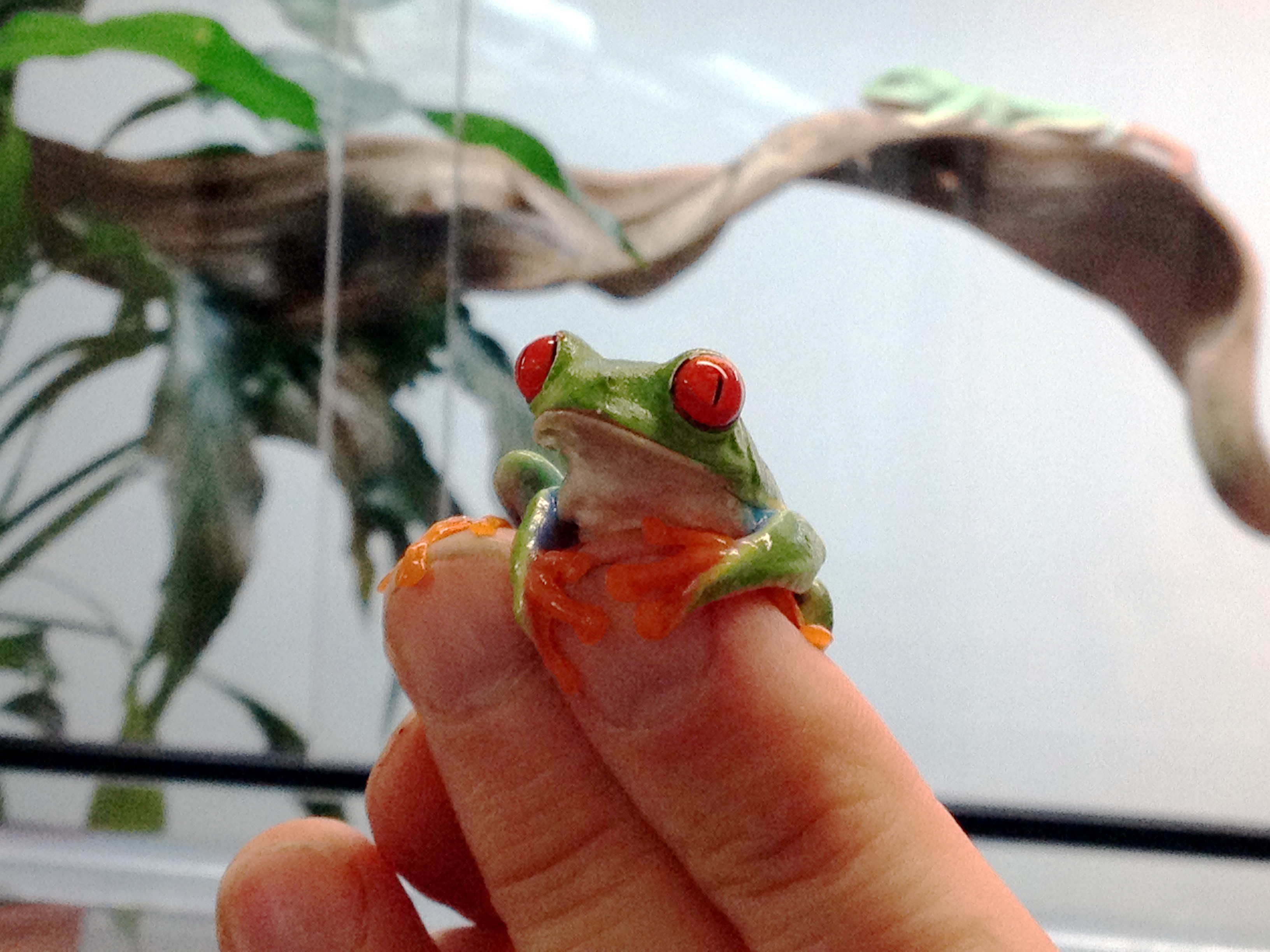
Leaf frog behind the scenes of the Vivarium, Manchester Museum – Taken by Matt Ramirez
The second phase will focus on extending the Ancient Worlds App by using AR to annotate artifacts and objects found in the Egyptology exhibit and add a geospatial dimension through providing maps (where appropriate) of where the artifact/object was originally discovered.
Project aim
The aim of the project is to reinforce learning outcomes of museum collections by using interactive technologies both in situ and remotely which can draw together a wide range of multimedia content related to the object of interest and provide a geospatial context to collections.
Who’s involved?
– Gail Millin-Chalabi – Project Manager/ Geodata R&D Officer (Mimas)
– Matt Ramirez – AR Programme Manager & Developer (Mimas)
– Adam Bland – Vivarium Assistant (Manchester Museum)
– Andrew Gray – Curator of Herpetology (Manchester Museum)
– Stephen Devine – New Media Officer (Manchester Museum)
What happens next?
The next few months will be busy with the Vivarium staff providing the required content e.g. photographs of frog species, frog descriptions and spatial distributions.
Matt and I will be storyboarding the app/ visualisation tools during the next couple of weeks, identifying potential AR triggers in the Vivarium exhibit.
Stephen will be assisting with content requirements for the Ancient Worlds exhibits. We will keep you posted of project updates via the blog and Twitter, using the tag #MappingtheMuseum.
To find out more about the Vivarium please visit the Frog Blog.
Reblogged this on Apparmo.
Pingback: Vivarium App Development | FROG BLOG MANCHESTER
Pingback: Vivarium App Development | SCARLET (Special Collections using Augmented Reality to Enhance Learning and Teaching)
Pingback: Mapping Amphibians and Reptiles! | AR at Mimas
Pingback: Going Chameleoco! | FROG BLOG MANCHESTER
Tom and I are really excited to be part of the Big Saturday: World of Reptiles event. Come along and try out the Virtual Vivarium for yourself. I am especially looking forward to seeing the wonderful chameleons and listening to the live music 🙂
Pingback: Introducing the Fabulous Frog App: Splendid and Native | AR at Mimas
Pingback: Vivarium App Development | archaeoINaction
Pingback: Introducing the Fabulous Frogs App: Splendid and Native | archaeoINaction
Pingback: Mapping Amphibians and Reptiles! | archaeoINaction