AR Digest
The latest AR news related to the latest developments Jisc have been been involved in Read more

The latest AR news related to the latest developments Jisc have been been involved in Read more
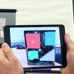
Over the past couple of months I have been working with colleagues from the Landmap service at Mimas to create an AR experience around the UKMap dataset. The UKMap Collection is one of five collections provided free of charge to the UK academic community at Landmap and was originally collection by The GeoInformation Group. This … Read more